







Timber origin geolocation data is now a hard question in our buyer calls distributed ledger systems 1. When we ship wax-dipped wood firestarters to UK distributors, "where was this wood harvested?" no longer accepts a country name as an answer. Miss the detail, and a shipment can stall at customs, an audit can fail, and a retail listing can vanish overnight. After 17 years of exporting wood-based fire products to 30+ countries, we built a data workflow that answers this question before anyone asks it.
To prepare timber origin geolocation data for UK deforestation rules, collect plot-level coordinates in decimal degrees (WGS84), use polygons for plots over 4 hectares, pair coordinates with harvest permits and legality documents, store everything in structured digital formats, and verify each record against satellite deforestation data.
That is the short version. The rest of this article walks through the format, the supplier process, the documentation, and how to scale it across a multi-tier supply chain.
What geolocation data format do I need to meet UK deforestation compliance requirements?
A German buyer once returned our origin file because the coordinates had only two decimal places. That mistake taught our compliance team a lesson: precision is not a preference, it is a specification.
UK deforestation compliance requires plot-level coordinates in decimal degrees using the WGS84 reference system, with single-point coordinates acceptable for small plots and polygon boundaries for plots over 4 hectares, stored in interoperable digital formats such as GeoJSON, KML, or shapefiles.

Let me break down what "the right format" actually means in practice, because this is where most timber datasets fail before anyone even reviews the legality documents.
UK rules vs UK timber legality vs EUDR
First, understand the regulatory landscape. The UK already has the UK Timber Regulations 2, which focus on illegal harvesting. The newer UK forest-risk commodity framework under Schedule 17 of the Environment Act 2021 3 adds a broader due-diligence layer, and UK government proposals target businesses above a £1 million turnover threshold. The Règlement de l'UE sur la déforestation 4 (EUDR) is the most prescriptive: it explicitly requires latitude and longitude with at least six decimal digits, and it makes the operator — not the producer — responsible for data accuracy. The UK rules are still being clarified, but they are clearly heading in the same direction. In our experience serving both UK and EU distributors, preparing one EUDR-grade dataset covers both markets.
The format specifications that matter
| Élément | Exigence | Échec courant |
|---|---|---|
| Coordinate system | WGS84, decimal degrees | Local grid systems or degrees-minutes-seconds |
| Précision | At least 6 decimal digits (EUDR standard) | 2–3 decimals, giving kilometre-level vagueness |
| Small plots | Single point coordinate acceptable | Postal address or forest name instead |
| Plots over 4 hectares | Polygon boundary required | Single point submitted for a large concession |
| File format | GeoJSON, KML, or shapefile | Map screenshots embedded in PDFs |
| Linkage | Coordinates tied to batch, harvest date, species | Coordinates floating free of any shipment record |
A polygon is not exotic. It is simply a series of coordinate pairs tracing the plot boundary, closed back to the start point. Most GIS tools and even free mapping apps can export one. The critical point is that a screenshot of a map is not data. Regulators and downstream operators need machine-readable files they can load into verification systems and cross-check against satellite imagery. If your supplier can only send a PDF map, budget time to digitise it — or better, help them capture it properly at source.
How do I collect and verify timber origin coordinates from my suppliers?
When we first asked our wood-shaving suppliers in Zhejiang for harvest coordinates, one sent back the address of his sawmill office. That gap — between what suppliers think you need and what regulators require — is the real collection challenge.
Collect coordinates by requiring GPS capture at or near the point of harvest, using mobile mapping apps or handheld GPS devices, then verify each record against satellite platforms such as Global Forest Watch and confirm the coordinates fall inside a plausible forest area matching the declared species and harvest date.
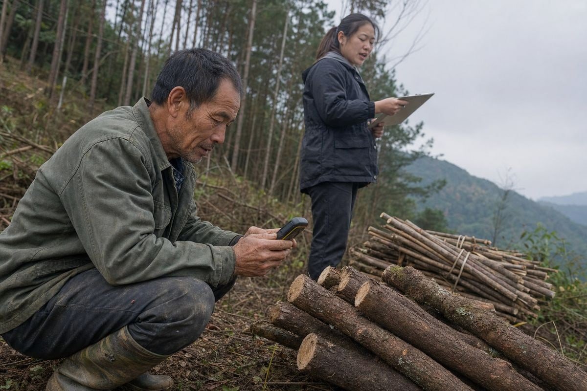
Collection and verification are two separate jobs. Treat them that way, and your dataset becomes defensible. Merge them, and errors slip through unchecked.
A five-step collection and verification process
- Onboard the supplier with a data specification, not a vague request. Send a one-page template stating the coordinate system (WGS84), precision (six decimals), file format, and the requirement to link coordinates to a specific harvest event. We learned to include an example file — it cuts back-and-forth by weeks.
- Capture at the point of harvest. Coordinates should be recorded at the stump or plot boundary using a GPS device 5 or a mobile mapping app. In dense canopy or remote terrain where GPS signals drift, high-resolution satellite imagery or drone-based mapping can supplement ground readings.
- Attach the coordinates to a harvest event. Every coordinate set needs a harvest date or date range, species, quantity, and a batch or lot identifier. A coordinate without a linked shipment is orphan data.
- Run an independent cross-check. Before you accept the record, plot the coordinates on Global Forest Watch 6 or a similar deforestation monitoring platform. Check three things: the location is actually forested, the forest type matches the declared species, and there is no recent deforestation alert on that plot.
- Log the verification. Record who supplied the data, when, how it was checked, and what the check found. Under the EUDR model, the operator carries responsibility for accuracy — so your audit trail is your defence.
Our quality team applies the same batch-to-batch discipline we use on burn-time testing to this data: every incoming lot of wood wool gets its origin record checked before the lot enters production. A coordinate that fails the satellite cross-check gets quarantined, exactly like a failed physical sample would.
What documentation should I request from manufacturers to prove legal harvesting sources?
One of our long-standing UK fireplace distributors asks for our full legality pack before every annual contract renewal — permits, chain-of-custody records, and third-party test reports together. That habit of theirs shaped how we now package origin evidence for every buyer.
Request harvest permits, land tenure or concession documents, legality certificates, chain-of-custody records, species and quantity declarations, harvest dates, and supplier details — all linked to the geolocation coordinates — so each shipment carries documentary proof of both legal harvest and deforestation-free status.

Coordinates alone prove where. Documents prove that the harvest at that location was legal and that the land was not recently deforested. UK due diligence statements must pair the two. Here is the document set a serious buyer should demand, and what each item actually proves.
The core documentation checklist
| Document | Ce qu'elle prouve | Qui le délivre |
|---|---|---|
| Harvest permit / felling licence | The harvest was legally authorised | Local forestry authority |
| Land tenure or concession record | The harvester had rights to that plot | Government land registry or concession holder |
| Legality certificate (e.g., FSC/PEFC claims, national schemes) | Third-party assurance of legal sourcing | Organisme de certification |
| Chain-of-custody record | The timber in the shipment came from the declared plot | Each supply chain actor |
| Species and quantity declaration | The product matches the declared material | Manufacturer or exporter |
| Harvest date or date range | The harvest falls after any relevant cutoff date | Harvester, confirmed by permit dates |
| Satellite or imagery evidence | The plot was not deforested after the cutoff | Monitoring platform or verification provider |
A few practical warnings from our export experience. First, check that document dates align: a harvest permit dated after the declared harvest is an instant red flag for any auditor. Second, insist that documents reference the same plot identifier and batch number as the coordinates — a permit for "Forest Compartment 7" is useless if your geolocation file names the plot differently. Third, remember record retention. UK Timber Regulations require traders to keep traceability records for five years, so build your storage around that horizon, not around a single shipment. When we prepare compliance packs alongside our SGS et Intertek 7 product test reports, we treat origin documents with the same rigour: one shipment, one complete, cross-referenced file.
How can I streamline geolocation data collection across multiple supply chain tiers?
Wood wool for our firestarters passes through a harvester, a processor, our production line in Ningbo, and then a freight forwarder before it reaches a UK warehouse. Every one of those handoffs is a place where origin data can quietly disappear.
Streamline multi-tier collection by assigning unique IDs to plots, batches, and shipments, building one master data template with validation rules, requiring GIS-ready files at supplier onboarding, digitising records into machine-readable formats, and structuring the dataset to satisfy both UK FRC and EU EUDR standards simultaneously.

The failure mode in multi-tier chains is always the same: each tier keeps its own records in its own format, and nobody links them. The fix is structural, not heroic. You need one data spine that every tier feeds into.
Build a single master template
Define the required fields once and enforce them everywhere. At minimum: supplier name and role, species or product description, quantity, batch/lot ID, country and sub-national region of harvest, harvest date range, plot coordinates or polygon file, and attached legality documents. Add validation rules — six decimal places, WGS84 only, no empty harvest dates — so bad data is rejected at entry, not discovered at audit.
Assign IDs and never break the chain
Give every harvest plot, every batch, and every shipment a unique identifier, and carry those IDs through each processing step. When a UK regulator asks which plot supplied the firestarters in container X, the answer should be a lookup, not an investigation. Some businesses go further and use blockchain or distributed ledger systems 8 to create timestamped, tamper-evident trails — useful for shortening audit and dispute timelines, though a disciplined conventional database achieves most of the same benefit.
One dataset, two markets
| Approach | Effort | Risque |
|---|---|---|
| Separate UK and EU datasets | Duplicate collection, duplicate formatting | Inconsistencies between the two versions invite scrutiny |
| Single EUDR-grade dataset for both | One collection effort at the stricter standard | Minimal — the stricter format satisfies both regimes |
| Collect minimally, upgrade later | Low effort now | Retro-collecting plot data from past harvests is often impossible |
Because the UK framework is converging toward the EU model, we advise our distributor partners to collect once at the EUDR standard. Retrofitting geolocation onto last year's harvests is the one job in compliance that money genuinely cannot fix.
Conclusion
Timber origin geolocation data is now a market-access asset. Collect plot-level coordinates properly, pair them with legality documents, verify against satellites, and structure one dataset for both UK and EU rules.
Notes de bas de page
1. Background concept on distributed ledgers, mentioned as an option for tamper-evident traceability. ↩︎
2. UK government guidance on timber legality and record-retention obligations discussed in the article. ↩︎
3. Official UK legislation text establishing Schedule 17 forest-risk commodity due-diligence rules. ↩︎
4. Official EU source explaining EUDR geolocation and due-diligence requirements referenced throughout. ↩︎
5. Background on GPS technology used to capture harvest-point coordinates described in the process. ↩︎
6. Primary satellite monitoring platform used to verify supplier coordinates against deforestation alerts. ↩︎
7. SGS is a recognized third-party testing and certification body referenced for compliance packs.



 English
  Spanish
  German
  French
  Arabic
  Portuguese
Rejoignez la conversation